Hurricanes are one of nature’s most powerful and destructive storms, causing heavy rainfall, inland flooding, storm surges, strong winds, rip currents, and tornadoes. They’re a force beyond our control unless we can produce a means of forewarning. Advanced technology in hurricane prediction may have enabled us to do just that.
The sheer power of nature is capable of teaching us lessons in humility. The forces of nature surround us and operate in majestic ways. Nature abides by its own rules, and we are at its mercy. Who is not humbled by the sight of the cosmos above us? They both intrigue and inspire a sense of awe. Wondrous sunsets always captivate. At these times we bear witness to nature at its very best. Other times nature can be a force to contend with.
Definition of hurricane
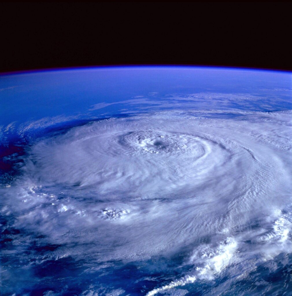
A hurricane is a severe storm with violent winds. A hurricane’s rotating (closed circulation) winds create the eye of the storm, where there is a calm and clear centre, surrounded by the eyewall, the part of the storm where wind forces are the strongest.
Typhoons and cyclones are the same type of storm and are classified based on where they occur. The term hurricane is specific to the North Atlantic and central and eastern North Pacific. In the western North Pacific, typhoon is the correct term, while cyclone is the proper term in the South Pacific.
Maximum wind speed determines the type of storm, as measured by the Beaufort Scale:
- under 62 kph = tropical depression
- 62 kph – 117 kph = tropical storm
- 118 kph or more = hurricane
Across the surface of the ocean, thunderstorms develop when water becomes warm and wind conditions are favourable. Heat energy—the fuel for the storm—is picked up from the water, creating substantial moisture in the air and leading to intensive hurricanes.
Predicting rapid storm intensification presents a challenge for researchers, meteorologists, and climatologists. Such intensification causes extensive damage and loss of life. Having real-time monitoring data will prove critical in predicting such storms when they are on the horizon.
Partnerships formed
National Oceanic and Atmospheric Administration (NOAA), Pacific Marine Environmental Laboratory (PMEL), and Atlantic Oceanographic and Meteorological Laboratory (AOML) have partnered with Saildrone Incorporated to observe oncoming hurricanes in real-time.
Saildrones are unmanned surface vehicles (USVs) that use low-carbon technology such as wind and solar energy. They measure various environmental factors such as wind speed, wave height, temperature, pressure, and salinity. The drones transmit data to weather prediction agencies that use this data in forecast models.
During peak hurricane season, which runs from August 1– October 31, these drones measure near-surface atmospheric and upper-ocean criteria used to calculate energy and momentum fluctuations within the atmosphere and the ocean within and outside of a hurricane. With a newer design, Saildrone has developed a more sturdy wing capable of withstanding wind speeds over 120 kph and large breaking waves.
In partnership with the NOAA, Saildrone deployed two USVs in a successful mission in 2021 and seven during hurricanes in the western Atlantic, Caribbean, and Gulf of Mexico in 2022, again with great success.
Speaking about this partnership, Saildrone founder and CEO Richard Jenkins says:
And speaking about NOAA’s role in this partnership, Chidong Zhang, Director of the Ocean Climate Research Division at NOAA’s Pacific Marine Environmental Laboratory (PMEL) adds:
Sense of assurance
Hurricane season is a time many people dread. With advances in hurricane prediction, perhaps we can breathe a sigh of relief and hope for a favourable outcome.